

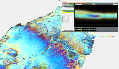
Validate
Validate has been developed as part of a three year project with industry partners and is a forward modelling tool that will help you understand what the colors mean in the RGB Blends.
It allows you to validate your interpretation by:
- Assessing the uncertainty.
- Predicting how fluid changes will appear in your data.
- Understanding what causes the frequency changes in the RGB Blends.
Request access to Download the latest release .
On demand Webinar - See What's New in GeoTeric 2018.1
Further new features include:
Improved data management
Master project – allows multiple users to work from one GeoTeric project without the need to copy in all the seismic data, saving both time and disk space.
Non-seismic data e.g. well data can be loaded into the Master project and distributed across teams to ensure data integrity.
We have also introduced well log templates, assigning each log as they are imported to a template, which can then be centrally managed to ensure a standardized display of logs. The well log manager will ensure you can easily see what logs you have and assign them to the correct template if required. Logs brought across from our 3rd party links will bring the assigned template with them.
You can also select multiple wells and assign mutual properties to them in an easy way, ensuring easy management of multiple wells in the display.
Improved Usability extensions
Interpretation extensions:
- Polygon control for constrained growth as well as deletion.
- Improved in-scene interactivity by allowing you to right-click on Adaptive Faults and Horizons for fewer mouse clicks whilst interpreting.
- Improved surface visualization with a sharper display and more accurate positioning.
Report view - an easy image capture tool incorporating annotation, color tables, scale bars etc.
We have also continued to build on the performance work we did in 2017.2.2 by:
- Visualization interactivity/performance – slices and volumes in 3D scene – should reach higher resolution faster.
- Faster horizon cache on projects on network.
- Improved performance when adding multiple wells to scene.
Request access to Download the latest release .
On demand Webinar - See What's New in GeoTeric 2018.1
