Horizons interpreted in or imported into GeoTeric have a variety of uses at all scales, whether for detailed reservoir interpretation, or regional mapping over huge areas.
To adjust the level of resources used by GeoTeric for visualizing and managing those horizons to suit the objective, it is possible to control the horizon mesh density from the Horizon Points options.
This setting can be found from the main window by clicking Tools -> Options -> Rendering. The settings applied here will take effect when caching or re-caching any horizon.
 |
The number of horizon points determines the number of mesh vertices, and the simplification affects the smoothing. To change the settings for a horizon that was previously cached, simply right-click on it in the Project Tree and choose ‘Uncache’ to clear its previous rendered state, and then ‘Cache’ to give it the new one.
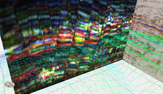
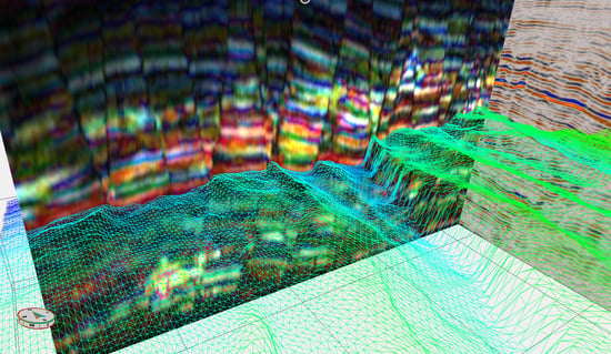
In the images below, two identical horizons were given different Horizon Rendering settings, and displayed in Height Value Wireframe. The top image was cached with 5000 horizon points, and 50% simplification, and hence has a sparse mesh. The lower image was cached with a setting of 100,000 points, and 100% simplification, and is much denser. The default, and recommended setting, is 80,000 points.
 |
The horizon points all consume memory. For an extremely spatially large horizon with a very dense mesh, this may result in less memory for other parts of the software to occupy when the horizon is displayed. Reducing the point density may result in faster performance, and is fine for regional marker horizons for example, where high detail is not required. For intra-reservoir interpretation, it is important to ensure maximum accuracy at small scale is achieved, by increasing the point density.


