GeoTeric's Geological Expression workflow incorporates ffA’s Adaptive Geobodies technology for on demand extraction of geological features from 3D seismic data.
Based on a data driven, interpreter guided approach The Adaptive Geobodies turns geobody detection into true volumetric geobody interpretation. With the Adaptive Geobodies: Geobody delineation is fast and robust and any geological element that is visible in the data can be delineated as a 3D object and be used in constructing a 3D geological model.
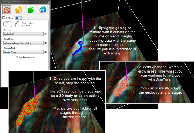
The Adaptive Geobodies can be created in some simple steps:
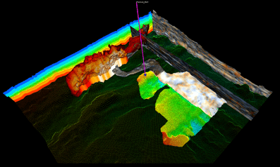
The geobody interpretation shown below illustrates how the Adaptive Geobodies technique can utilise data driven constraints provided by multiple attributes, combined with intuitive interpreter guidance techniques to understand the morphology of different components of a geological system. In this instance, geobodies representing components of a channel and fan system (channel core, channel margins and distal fan) have been interpreted.
Having interpreted the various geobody elements, further understanding can be gained by draping the surface of these geobodies with attribute maps and height values or populating the geobodies with information, such as thickness variations.


