

Structural reconnaissance of data can be rapidly interpreted with GeoTeric’s StructApp workflow. This provides insights into a regional or detailed overview of the structural environment. StructApp workflow can be found within the Processes and Workflows framework.StructApp calculates volumetric Dip, Azimuth and DipAzi combined volumes. They enable a rapid 3D overview and understanding of the regional and local structure without input from prior interpretation. The volumes can be visualised as a basis for new interpretation on both a regional and local scale, or can be used to QC existing interpretations. They can show large and fine scale structural trends, fractures, faults, flexures and folds and features such as channel systems, clinoforms, salt walls and shal or mud diapirs.The input to the StructApp workflow is a Noise Cancelled volume. StructApp then allows you to specify whether you are interested in Regional or Detailed structures. For smaller more detailed structures the suggested footprints are smaller but as always with GeoTeric, data driven, interperter guided approach the interprester has got full control over this.
 |
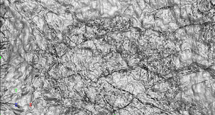
| Time slice of Reflectivity data |
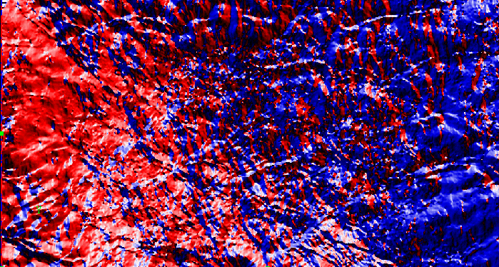
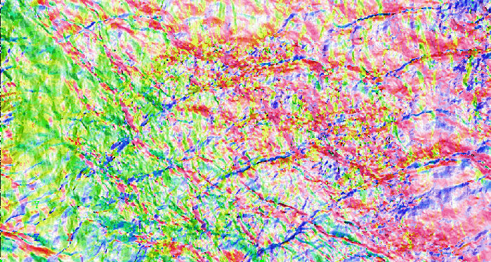
Dip volumes are normally viewed with a monochromatic colourmap; in this example white represents areas of low dip and black areas of high dip. Azimuth volumes are normally viewed with a rotary colourmap; in this example red represents structures dipping towards the west, blue towards the east, white towards the south and black towards the north (top).
 |
| Time slice of a Dip volume |
 |
| Time slice of an Azimuth volume |
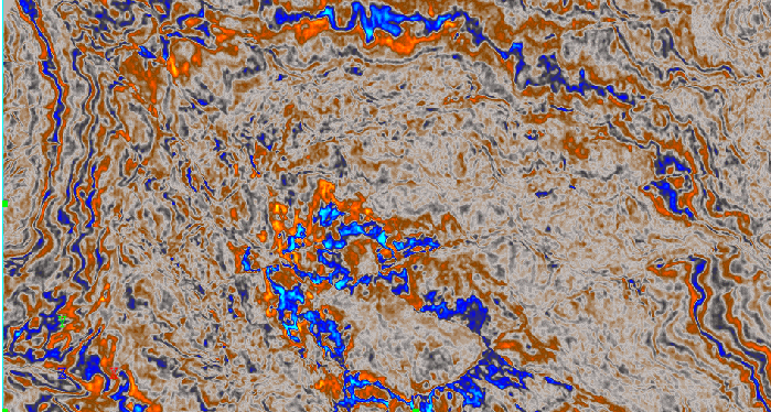
Using the DipAziCombine process, the Dip and Azimuth volumes can be combined to create one volume that visualises both sets of information simultaneously.
 |
| Time slice of DipAziCombined volume |
The azimuth is expressed as colour variation and the dip as colour saturation. Viewing the DipAziCombine volume requires a special colourmap to allow both sets of information to be viewed. In the DipAziCombine time slice, pale areas have a low dip, saturated colour is greater dip, black is high dip. Green areas represent structures dipping towards the southwest, yellow to the northwest, yellow/green towards the west and blue towards the southeast. If the general structure is low dip to flat then the DipAziComine volume will be pale or white.
