For those who were unable to attend EAGE last week, here is an update on some of the latest functionality to become available in the 2014.2 release of GeoTeric. (to be released second half of July)
Interpretation on colour blends is extended in GeoTeric 2014.2 incorporating both manual and data driven interpreter guided methods.
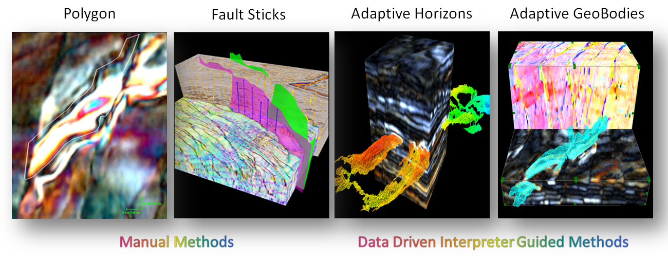
Adaptive Horizons – Adaptive Horizons uses the data from multiple, colour blended attribute volumes to guide the data driven surface growing whilst you can interactively change the growth parameters and criteria using your interpretation knowledge and experience. This intuitive tools lets you step through the horizon growth in 3D space and make changes at any time, so it is easy for you to achieve a good result very quickly.
Adaptive Geobodies – With the Adaptive Geobodies, geobody delineation is fast and robust so that any geological element that is visible in the data can be delineated as a 3D object and be used in constructing a 3D geological model.
Fault Sticks/Surfaces – With a simple interface and no learning curve, defining fault sticks on the colour blends inside GeoTeric’s 3D visualisation space will shorten the workflow and save you time, whilst ensuring you don’t miss the detail.
Polygons – As a complement to the Adaptive Horizons and Adaptive Geobodies tools, GeoTeric also allows you to highlight features of interest by drawing polygons and creating fault sticks.