GeoTeric is very pleased to announce that GeoTeric 2016.1 is now available for download from our ftp site. To get the link either contact our Support team or login to the client section of the website.
GeoTeric 2016.1 contains the following changes:
Faster:
- All 3D processing in GeoTeric is much faster- including the data I/O. Depending on your system, you can reduce time taken from start until you can use the data by 90%.
- Expression tools have been re-designed to handle larger datasets and have been given a performance boost as well.
In order to achieve the speed improvement we have changed the file format, meaning there is an upgrade step. For full step by step instructions for the upgrade- please see here.
- Removed the separate large cache stage so there is only 1 "green progress bar". A separate display file is created during the creation of the datafile but it's only about 20% of the size of the original datafile.
- The colour blends no longer require caching. Instead all the blending is now down using the GPU (Note! this has increased the minimum driver version to be more than 340.XX- see here for full details)
Despite having removed the separate Cache stage the functionality and quality of volumes and blends has remained the same.
Even Easier to use:
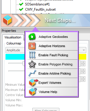
- Right-click options for the most commonly used functionality for all items visualised in 3D scene and context sensitive What's Next" option. Intuitive options to make your workflows more streamlined, with fewer mouse clicks. The options include easy access to all the Interpretation objects as well as item specific functionality for that item.
- Display of colour tables in 3D scene (switch on in View menu) as well as improved 2D scale bars.
More technology:
- Spectral Expression:
- Ability to save and load your target, original or enhanced spectrum curve, ensuring you are always able to repeat your workflow, improved reporting and means you to extend Spectral Expression to be used in AVO/4D workflows.
- You are now able to change the minimum frequency used in the analysis to work with low frequency data including broadband and depth data.
- For greater repeatability and control you can now enter the 4 corner points of your spectrum curve together with the slope of the spectrum.
- Spectral Expression now supports spectral suppression.
- Ability to change scale of the curve for improved visibility as well as frequency read outs on values along the 3 curves.
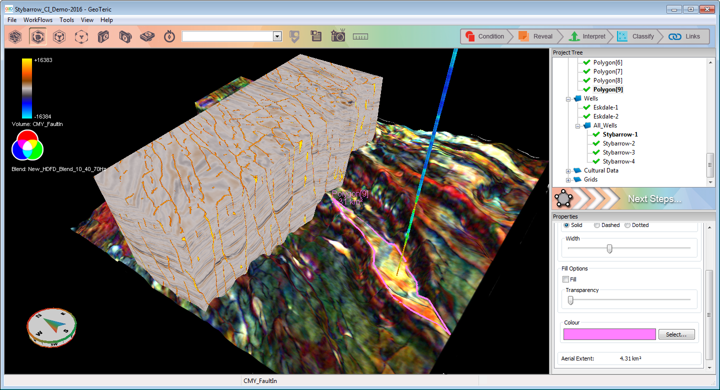
- Polygon interpretation in the 3D scene, available from Interpretation menu or the new right-click or 'Next Steps'. Polygons can be picked on all items in the scene.
- You can also change the outline of the polygon from solid line to dashed or dotted as well as fill it in with a varying transparency.
- Polygon's also display their aerial extent measurements.
- Polygons can now be transferred across the 3rd party Links.
- Improved Arbitrary Line picking. Accessible from the Interpretation menu or right-click / 'Next Steps' menu.
- Ability to display colour blends on Arbitrary Lines.
- Now works in same way as all other picking tools in GeoTeric.
- Fixed all the issues in previous version of GeoTeric linked to the Arbitrary lines incl. instability crashes, colour map not updating properly etc
- Ruler in 3D scene- accessible from Ruler tool bar icon.
- Opacity Blends can now be used as an interpretation object with both polygons and fault sticks.
Other:
- Well log colour maps are now displayed over actual log range and can be reversed.
- Wells transferred across the Link to DSG now use the TD curve as well.